Archives
Enter a word or phrase to perform a general search across all records in the Archives catalog. You can also browse records in the catalog without performing a search.
Search Tips
- Searches are not case sensitive.
- Searching for multiple words connects them with OR by default. Matching records can contain any of the words.
- Connect multiple words with AND if you only want to see records containing both words.
- Use quotation marks to search for a phrase.
- Place an asterisk (*) at the end of a word as a wildcard.
1498 results found. Records searched: 1498
-
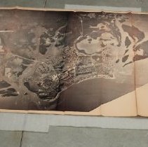
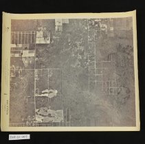
Survey, Land - 2014-36-002
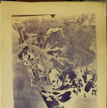
Black and white aerial photograph of Marco Island, Goodland, Isles of Capri, south Naples, and Fakahatchee State Park (currently). Shows several areas of development on Marco Island. Most likely used for land surveying or zoning. Text in the proper left bottom corner reads "Marco Island, Fla."
Record Type: Archive
-
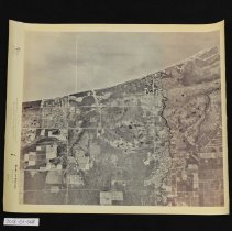
Survey, Land - 2014-36-003
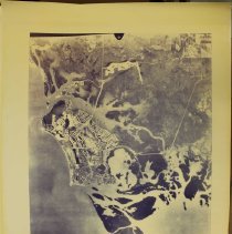
Black and white aerial photograph of Marco Island, Goodland, Isles of Capri, south Naples, and Fakahatchee State Park (currently). Shows several areas of development on Marco Island. Most likely used for land surveying or zoning. Text in the proper left bottom corner reads "Marco Island, Fla."
Record Type: Archive
-
Survey, Land - 2014-36-004
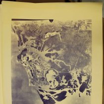
Black and white aerial photograph of Marco Island, Goodland, Isles of Capri, south Naples, and Fakahatchee State Park (currently). Shows several areas of development on Marco Island. Most likely used for land surveying or zoning. Text in the proper left bottom corner reads "Marco Island, Fla."
Record Type: Archive
-
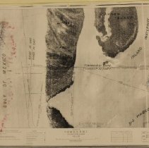
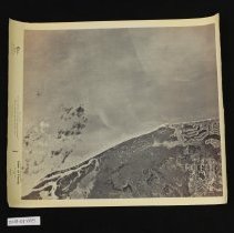
Survey, Land - 2014-42-001
Aerial land survey of the 10,000 Islands. Text in the proper right bottom corner reads "U.S. Coast and Geodetic Survey, State Florida, General Locality West Coast, Locality Rabbit Key to Tiger Key, Aerial Phototopographic Survey, Surveyed by Photographs reduced by O.S. Reading, Chief of Party R.P. Eyman, Date February 1927, Scale 1:20,000, Inked by Photolithographic Print retouched by O.S.R."
Record Type: Archive

-
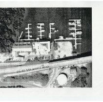
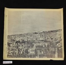
Survey, Land - 2016-24-033
Black and white photocopy of an aerial land survey around San Marco Road near the Goodland Bridge. Boats docked in the water. Text on the survey reads "CR-92 San Marco Road."
Record Type: Archive
-
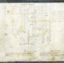
Survey, Land - 2017-01-1961
Photocopy of a land survey of Marco Island and the surrounding area, surveyed March 18th to April 5th, 1876. Text below the survey reads "The above Map of Township 52 South Range 26 East is strictly conformable to the field notes of the survey thereof on file in this Office which have been examined and approved. Surveyor General's Office. Tallahassee Florida, January 6th 1877". Text next to the survey reads "As per President's Order dated Apri...
Record Type: Archive
-
Survey, Land - 2017-06-004
Black and white aerial survey of the area around Marco Island. "Little Marco Island", "Cannon Island", "Inland Waterway", and "Big Marco Pass" included. Text across the bottom reads "Surveys In T. 52 & 53 S., R. 26 E., Collier County, Florida, Scale 1: 2400, (1 inch = 200 feet).
Record Type: Archive
-
Survey, Land - 2018-01-004
Aerial photographic survey of Marco Island. Text in the proper right bottom corner reads "Deltona Corp., Marco Is."
Record Type: Archive
-
Survey, Land - 2018-01-005
Aerial photographic survey of South Naples. Keewaydin Island and part of Cannon Island visible. Text across the bottom reads "Mark Hurd Aerial Surveys, Inc., State of Florida, Naples South, 583".
Record Type: Archive
-
Survey, Land - 2018-01-006
Aerial photographic survey of North Naples. Text across the bottom reads "Mark Hurd Aerial Surveys, Inc., State of Florida, North Naples, 582".
Record Type: Archive
-
Survey, Land - 2018-01-007
Aerial photographic survey of the Corkscrew area east of Naples. Text across the bottom reads "Mark Hurd Aerial Surveys, Inc., State of Florida, Corkscrew SW, 622".
Record Type: Archive
-
Survey, Land - 2018-01-008
Aerial photographic survey of Bonita Springs. Text across the bottom reads "Mark Hurd Aerial Surveys, Inc., State of Florida, Bonita Springs, 581".
Record Type: Archive
-
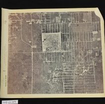
Survey, Land - 2018-01-009
Aerial photographic survey of the Belle Meade area in Naples. Text across the bottom reads "Mark Hurd Aerial Surveys, Inc., State of Florida, Belle Meade NW, 623".
Record Type: Archive
-
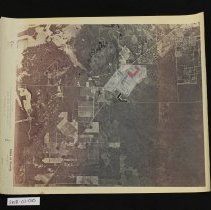
Survey, Land - 2018-01-010
Aerial photographic survey of the Belle Meade area in Naples. Text across the bottom reads "Mark Hurd Aerial Surveys, Inc., State of Florida, Belle Meade, 624".
Record Type: Archive
-
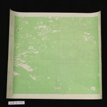
Survey, Land - 2018-01-011
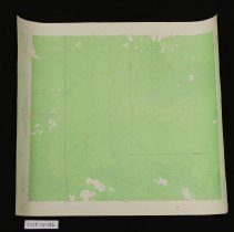
Geological survey of the Belle Meade area in Naples. U.S. 41 and (what would become) S.R. 951 intersecting in the center. Text at the top reads "United States Department of the Interior Geological Survey, Belle Meade Quadrangle, Florida - Collier Co., 7.5 Minute Series (Topographic)".
Record Type: Archive
-
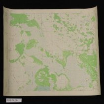
Survey, Land - 2018-01-012
Geological survey of the northwest Belle Meade area in Naples. Text at the top reads "United States Department of the Interior Geological Survey, Belle Meade NW Quadrangle, Florida - Collier Co., 7.5 Minute Series (Topographic)".
Record Type: Archive
-
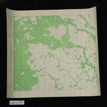
Survey, Land - 2018-01-013
Geological survey of the southeast Belle Meade area in Naples. Text at the top reads "United States Department of the Interior Geological Survey, Belle Meade SE Quadrangle, Florida - Collier Co., 7.5 Minute Series (Topographic)".
Record Type: Archive
-
Survey, Land - 2018-01-014
Geological survey of the Corkscrew area in Naples. Text at the top reads "United States Department of the Interior Geological Survey, Corkscrew Quadrangle, Florida, 7.5 Minute Series (Topographic)".
Record Type: Archive
-
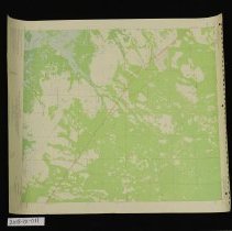
Survey, Land - 2018-01-015
Geological survey of the northwest Corkscrew area in Naples. Text at the top reads "United States Department of the Interior Geological Survey, Corkscrew NW Quadrangle, Florida, 7.5 Minute Series (Topographic)".
Record Type: Archive
-
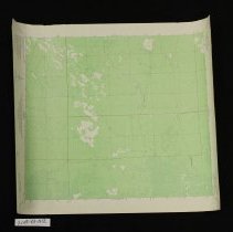
Survey, Land - 2018-01-016
Geological survey of the southwest Corkscrew area in Naples. Text at the top reads "United States Department of the Interior Geological Survey, Corkscrew SW Quadrangle, Florida, 7.5 Minute Series (Topographic)".
Record Type: Archive