Photos
Enter a word or phrase to perform a general search across all records in the Photos catalog. You can also browse records in the catalog without performing a search.
Search Tips
- Searches are not case sensitive.
- Searching for multiple words connects them with OR by default. Matching records can contain any of the words.
- Connect multiple words with AND if you only want to see records containing both words.
- Use quotation marks to search for a phrase.
- Place an asterisk (*) at the end of a word as a wildcard.
Photo Results
1819 results found. Records searched: 8823
-
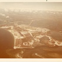
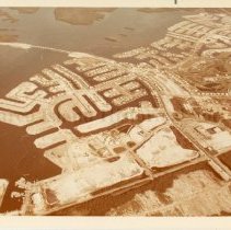
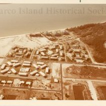
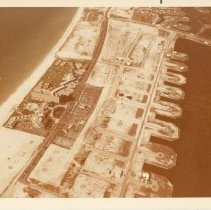
Print, Photographic - 2020-14-033
Color aerial photograph of the development of Marco Island north of the intersection of San Marco Rd. and S. Collier Blvd. Greenbriar St., Manor Terr., Wintergreen Dr., Dandelion Ct., Saturn Ct., Dove Ct., Sea Ct., Amazon Ct., Bluebonnet Dr., and Carribean Ct. are visible. Tradewinds, Emerald Beach, Sunset House, and Sunset House North condominiums are also visible along the waterfront, as well as the Seabreeze, Aquarius and Southwinds garden s...
Record Type: Photo
-
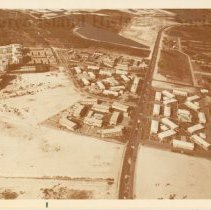
Print, Photographic - 2020-14-034
Color aerial photograph of the development of Marco Island along S. Collier Blvd. Greenbriar St., Saturn Ct., Castaway St., and Seaview Ct., are visible. Tradewinds, Emerald Beach, Sunset House, and Sunset House North condominiums are also visible along the waterfront, as well as the Seabreeze, Aquarius and Southwinds garden style condominiums along S. Collier Blvd. Photograph taken looking north.
Record Type: Photo
-
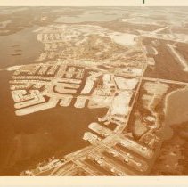
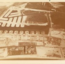
Print, Photographic - 2020-14-035
Color aerial photograph of the development of Marco Island east of Bald Eagle Drive. Marco River Bridge and the Marco Island Country Club are visible. Photo taken looking southeast.
Record Type: Photo
-
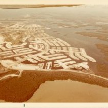
Print, Photographic - 2020-14-036
Color aerial photograph of the development of Marco Island east of Bald Eagle Drive. Marco River Bridge and part of the Marco Island Country Club are visible. Photo taken looking southeast.
Record Type: Photo
-
Print, Photographic - 2020-14-037
Color aerial photograph of the development of Marco Island north of San Marco Road. Marco River Bridge, North Barfield Rd., and part of the Marco Island Country Club are visible.
Record Type: Photo
-
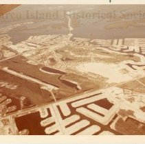
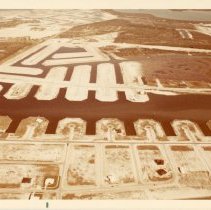
Print, Photographic - 2020-14-038
Color aerial photograph of the development of Marco Island. The Marco Island airstrip, Marco River Bridge, and the Marco Island Country Club are visible. A part of the plane's wing is captured in the top right corner of the photograph. Photo taken looking northeast.
Record Type: Photo
-
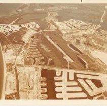
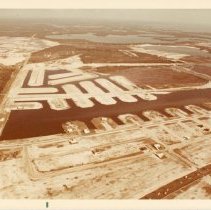
Print, Photographic - 2020-14-039
Color aerial photograph of the development of Marco Island from the Marco Beach Hotel and Villas north. The Marco Island airstrip, Marco Island Country Club, part of Marco Beach Hotel & Villas, "Condo Row" and the garden style condominiums along S. Collier Blvd. are visible. Photo taken looking north.
Record Type: Photo
-
Print, Photographic - 2020-14-040
Color aerial photograph of the development of Marco Island along S. Collier Blvd. Greenbriar St., Saturn Ct., Castaway St., and Seaview Ct., are visible. Tradewinds, Emerald Beach, Sunset House, and Sunset House North condominiums are also visible along the waterfront, as well as the Seabreeze, Aquarius and Southwinds garden style condominiums along S. Collier Blvd. Photograph taken looking west toward the Gulf of Mexico.
Record Type: Photo
-
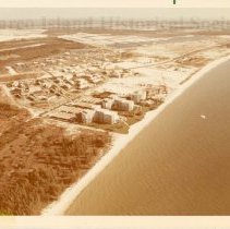
Print, Photographic - 2020-14-041
Color aerial photograph of the development of Marco Island along S. Collier Blvd. Saturn Ct., Castaway St., and Seaview Ct., are visible. Tradewinds, Emerald Beach, Sunset House, and Sunset House North condominiums are also visible along the waterfront, as well as the Seabreeze, Aquarius and Southwinds garden style condominiums along S. Collier Blvd. Photograph taken looking north.
Record Type: Photo
-
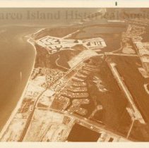
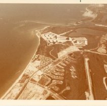
Print, Photographic - 2020-14-042
Color aerial photograph of the development of Marco Island from the north end of the island looking southeast. The marina, Bald Eagle Drive, and North Collier Blvd. are visible.
Record Type: Photo
-
Print, Photographic - 2020-14-043
Color aerial photograph of the development of Marco Island from the south end of the island looking north. Barfield Bay and San Marco Rd. are in the foregound. TPart of the plane's wing is visible along the top edge of the photograph.
Record Type: Photo
-
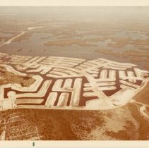
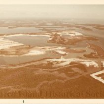
Print, Photographic - 2020-14-044
Color aerial photograph of the development of Marco Island of the south end of the island around Roberts Bay, Barfield Bay, and Caxambas Bay. Dredging where Hammock Ct., Conover Ct., Alameda Ct. and Sand Hill Ct. is visible on the left.
Record Type: Photo
-
Print, Photographic - 2020-14-045
Color aerial photograph of the development of Marco Island from the intersection of S. Collier Blvd. and San Marco Rd. north. The crescent beach, Marco Island airstrip, Marco Island Country Club, "Condo Row" and the garden style condominiums along S. Collier Blvd. are visible. Photo taken looking northwest.
Record Type: Photo
-
Print, Photographic - 2020-14-046
Color aerial photograph of the development of Marco Island north of the intersection of San Marco Rd. and S. Collier Blvd. Greenbriar St., Manor Terr., Wintergreen Dr., Dandelion Ct., Saturn Ct., Dove Ct., and Sea Ct. are visible. Tradewinds, Emerald Beach, Sunset House, and Sunset House North condominiums are also visible along the waterfront, as well as the Seabreeze, Aquarius and Southwinds garden style condominiums along S. Collier Blvd. T...
Record Type: Photo
-
Print, Photographic - 2020-14-047
Color aerial photograph of Marco Beach Hotel & Villas and the surrounding development of Marco Island taken looking northwest.
Record Type: Photo
-
Print, Photographic - 2020-14-048
Color aerial photograph of Marco Beach Hotel & Villas and the surrounding development of Marco Island taken looking north.
Record Type: Photo
-
Print, Photographic - 2020-14-049
Color aerial photograph of Marco Beach Hotel & Villas and the surrounding development of Marco Island taken from the Gulf of Mexico looking east. Part of the plane can be seen in the top right.
Record Type: Photo
-
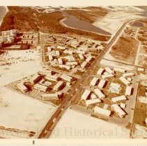
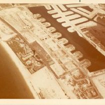
Print, Photographic - 2020-14-050
Color aerial photograph of the development of Marco Island on the opposite side of S. Collier Blvd. from the Marco Beach Hotel & Villas. The finger streets are (from left to right): Tulip Ct., Plum Ct., Maple Ct., Abaco Ct., Birch Ct., Ironwood Ct., and Daisy Ct. The streets behind these (further from the camera) include: Primrose Ct., Lamplighter Dr., Hickory Ct., Coronado Ct., Dill Ct., Dana Ct., Cara Ct., Bond Ct., Shenandoah Ct., Whiteheart...
Record Type: Photo
-
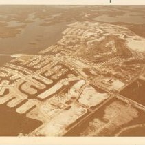
Print, Photographic - 2020-14-051
Color aerial photograph of the development of Marco Island south of the intersection of S. Collier Blvd. and San Marco Rd. The finger streets are (from left to right): Tulip Ct., Plum Ct., Maple Ct., Abaco Ct., Birch Ct., Ironwood Ct., Daisy Ct., and Aster Ct. The streets behind these (further from the camera) include: Primrose Ct., Lamplighter Dr., Hickory Ct., Coronado Ct., Dill Ct., Dana Ct., Cara Ct., Bond Ct., Shenandoah Ct., Whiteheart Ct...
Record Type: Photo
-
Print, Photographic - 2020-14-052
Color aerial photograph of the Marco Island in its entirety looking north.
Record Type: Photo